A new Month, a new Weather System - Winter Is Coming!
A new Month, a new Weather System - Winter Is Coming!
Published : 01-Nov-2016 19:45
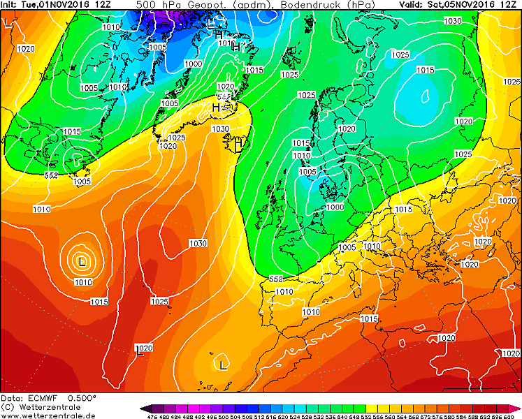
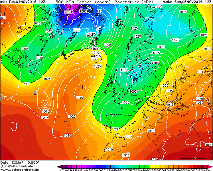
So... pretty much all the weather models have been swinging into agreement about a major change in the European weather starting at the end of this week.In essence, a vast mass of cold air will push South and West from Scandinavia and Siberia across Central Europe. At the same time, warm (and moist) air will push North and East from the Atlantic, Iberia and the Med. They'll rub alongside each other over The Pyrenees, The Alps and The Dolomites.
And where they meet, high above the mountains, there's going to be a lot of fallout! White fallout.
With such a scenario, it's very difficult to predict the exact evolution but we can say with some certainty that there will be some significant snowfall, and potentially some massive falls in a few locations.
The most uncertain part will be the rain/snow line; it looks likely to be high across The Pyrenees but potentially falling to mid and even low altitudes in The Alps and The Dolomites.
These two charts from Wetterzentrale, showing the predictions of the European (ECMWF) model, illustrate it quite nicely - although the colours used do exaggerate the differences...

Saturday 5th November, as forecast Tuesday 1st
Picture copyright of Wetterzentrale

Sunday 6th November, as forecast Tuesday 1st
Picture copyright of Wetterzentrale
We'll have more on this developing situation in our Weekly Snow Report on Thursday, but expect our Snow Storm Warnings and Powder Alarms to be winging their way into your Inboxes (you are signed up to our snow mail aren't you?) for the next week or so!
About Wetterzentrale
This is a great site if you want to explore the outputs and predictions of the major forecast models, with a wide variety of maps, charts and graphs. Start here :- www.wetterzentrale.de
Join the conversation : Discuss this in the J2Ski Forum
This news item has been viewed 3,865 times.