J2Ski Snow Report - February 5th 2026
J2Ski Snow Report - February 5th 2026
Published : 05-Feb-2026 20:21
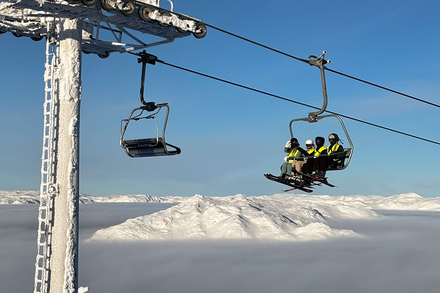
Hemsedal, Norway, it's been sunny but cold above the clouds...
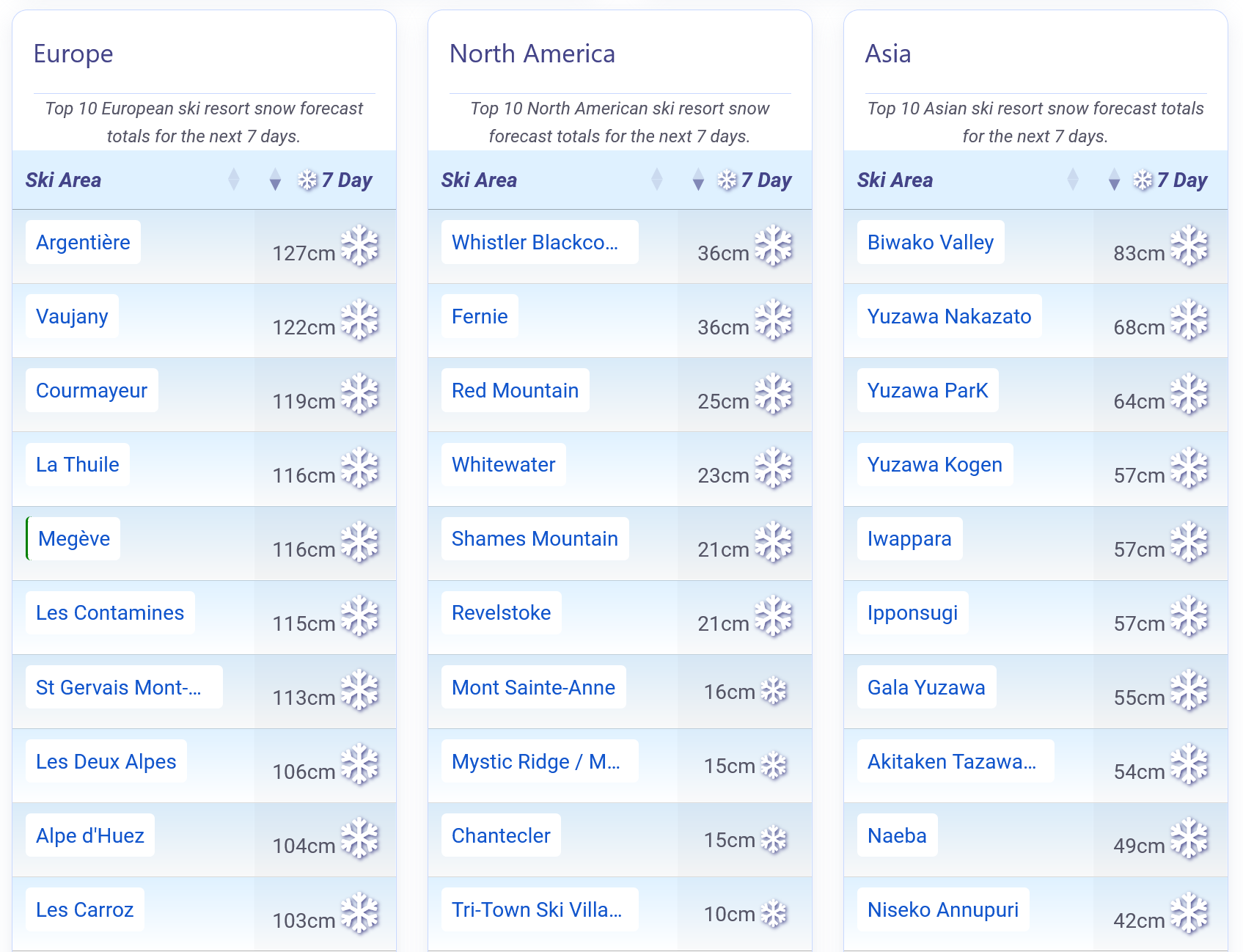
Europe continues to see frequent snow, with more snowfall in the Pyrenees, the southern Alps and Scotland. America remains a mixed picture, whilst there have been huge falls in Japan.
The Snow Headlines - February 5th
- More huge snowfalls in Japan, again, world's deepest base this season passes 6 metres/20 feet.
- Scottish ski areas report most snow in years.
- Big snowfalls once again in the Pyrenees and southwestern Europe.
- Bulgaria now receiving regular snowfall top ups.
Incoming Snow forecast for the Alps.
Re-publication :- the J2Ski Snow Report Summary, being the text above this line, is free to re-publish, but must be clearly credited to www.J2ski.com with text including "J2Ski Snow Report" linked to this page - thank you.
World Overview
Unsettled weather has dominated Europe's ski regions for a second week, with the Pyrenees, the southwest and the southern Alps again seeing the most consistent snowfall. The Dolomites have also had fresh snow, leading to the cancellation of training runs ahead of this weekend's Olympic Downhill races.
Elsewhere, accumulations have been lighter but widespread. Scandinavia has stayed cold with occasional top-ups, while Scotland enjoyed its best week of the season, allowing most centres to open far more terrain. Bulgaria has also benefited from another burst of cold, snowy weather.
Across the Atlantic, the pattern remains split. The western US and Canada are largely dry, sunny and mild, while the East and Midwest continue to endure deep freezes and repeated winter storms. Despite the contrast, terrain access is improving almost everywhere, with many Colorado resorts now 80–95% open.
In Japan, Seki Onsen, which reached a 5 m/16 feet base last week, has now set a new world's deepest snowpack this winter at 6 m/20 feet, after further intense snowfall.
Europe
Austria
It has been another week of changeable conditions in the Austrian Alps with low temperatures, light snowfalls, sunny spells and low cloud limiting visibility all thrown into the mix. The snow surface remains hard packed with freeze-thaw conditions in valleys and the forecast is for more of the same for the coming week.
The country's largest ski areas continue to battle to open terrain with the snowpack well below its usual levels. The Arlberg around St Anton and Lech continues to post the most open, about 80% of its slopes with the SkiWelt, not far behind. The Saalbach-Hinterglemm region remains only 50% open.
Current forecasts are for generally light, scattered snow over the next week - enough to freshen slopes but huge falls are unlikely.
France
France has had a good start to February with widespread snowfall and low temperatures over the past week. Most of the country's ski areas are also at or near to full operations as the busy school holidays period nears. As has repeatedly been the case this season, the southern French Alps have seen the most snowfall over the past few days with Isola 2000 down towards Nice posting a 60 cm/24 inches accumulation, Les 2 Alpes 55 cm/22 inches, Alpe d'Huez 45 cm/18 inches and Puy St Vincent 30 cm/12 inches.
There has been snowfall further north too and unsettled weather is expected to continue.
Significant new snow is now in the forecast for next week, with potential disruption looming with large falls possible for the mid-February holiday changeover weekend.
Italy
Snowfall across Italy has continued on and off since last week, with many resorts collecting 25–50 cm/10 inches to 20 inches over the past seven days. The timing is ideal for Olympic venues, which had been preparing to rely almost entirely on artificial snow. While machines are still doing most of the work, a welcome layer of natural snow now sits on top.
Cortina d'Ampezzo has seen its base more than double to 100 cm/39 inches with the fresh snow after a lean December and early January. Most Italian ski areas are now 90–100% open with the Milky Way, with around 300 km/186 miles of slopes open, reporting the most.
The week ahead looks cold and settled, with only light snowfall top-ups expected - although he Aosta Valley resorts could pick up substantial snow mid-week.
Switzerland
Swiss resorts have enjoyed a second week of steady snowfall, with up to 75 cm/30 inches falling in 72 hours, particularly in the west. It's a welcome boost, as national base depths remain around two-thirds of the seasonal norm.
Glacier 3000, already holding the country's deepest cover at nearly 5 metres/16 feet, has added more than a metre/3 feet in ten days.
Avalanche danger has risen to level 3 or 4 in many regions.
The 4 Valleys currently offers the most terrain open, with more than 320 km/199 miles of pistes.
Cold air stays in place this week, with heavy snow possible mid-week in the west of the country - light top-ups and well-preserved snow at altitude elsewhere.
Scandinavia
Bitter cold continues to shape conditions across Scandinavia, with some resorts closing exposed lifts as temperatures plunge into the -20s °C and windchill pushes readings closer to -30 °C. Despite the freeze, most areas still offer the bulk of their terrain, and lengthening daylight is setting up a promising second half of the season.
Snowfall has been limited, with generally light weekend accumulations of 5–10 cm/2 inches to 4 inches. A few spots have done better: Norway's Kvitfjell picked up around 20 cm/8 inches earlier in the week. Sweden's Åre has the most terrain open, with about 80% of its 80 km/50 miles of pistes available.
Pyrenees
The Pyrenees's great season continues, picking up another round of welcome snowfall, with the heaviest totals in the central and west of the region where some resorts saw 20–40 cm/8 inches to 16 inches in recent days. Colder air has settled in, keeping upper-mountain temperatures well below freezing and helping preserve the new cover. Winds have been variable but occasionally strong along higher ridgelines, prompting intermittent lift closures.
Avalanche danger currently sits at level 3 in many areas due to wind-loading and fresh accumulations. The week ahead looks wintry, with sub-zero nights, light top-ups drifting through, and generally stable conditions on sheltered pistes.
Scotland
Scottish ski areas are enjoying their best conditions in years after a consistently cold, snowy January.
Glenshee reports 'tons of snow', and once weather allows, all four main centres have been offering extensive terrain and excellent skiing. Typical Scottish challenges remain, with drifting snow blocking roads and gale-force winds halting lift operations at times. Nevis Range, which hasn't opened for snowsports for several years and lacks the working all-weather snowmaking the other four centres have, hopes to open for the first time for several winters from Friday if preparations succeed.
With continued cold forecast into February, many are hopeful this could become one of Scotland's strongest winters of the century.
Eastern Europe
It's been looking good across Eastern Europe for a while now.
The one weak area had been the Balkans, but they now seem to be getting the regular snowfall that's been moving across southern Europe and indeed north Africa along with cold temperatures leaving the slopes in excellent shape.
Further north things have been better for longer and the past week has brought light snowfall and subzero temperatures to ski slopes in Slovenia, Slovakia, Czechia and Poland, further improving conditions.
North America
Canada
Dry, bright weather has lingered across Western Canada into February, but with the past few days bringing a noticeable warm-up after January's deep freeze. Freezing levels have lifted, light snow has been reported in some areas, and most resorts remain at full operations.
Eastern Canada remains locked into a much colder pattern however, with temperatures down between -10 and -25 °C, and after a sunny start to the week it's been getting more unsettled and snowy. Le Massif, which had said it was ending its season due to a labour dispute, has resumed operations following a three-week closure.
Revelstoke currently reports the country's deepest base, while Whistler Blackcomb leads North America for terrain open.
USA
North America's ski season continues its split personality.
The West stays mostly dry, sunny and unusually mild, with only brief cold snaps in the Northwest. Base depths remain serviceable thanks to big early-season storms in California, and most resorts are largely open, though Colorado still leans on snowmaking.
In contrast, the East and Midwest remain locked in deep cold, with regular snowfall and excellent coverage. Killington leads the region with almost all terrain open. The Rockies remain generally dry, cold enough to preserve cover, but still waiting for a meaningful pattern shift. Light snow is possible at higher elevations, yet widespread relief looks unlikely before mid-February.
Join the conversation : Discuss this in the J2Ski Forum
This news item has been viewed 261,278 times.
Also on J2Ski :- Alpe d'Huez Snow Forecast Ski Hotels Ski Hire Ski Holidays