J2Ski Snow Report - February 12th 2026
J2Ski Snow Report - February 12th 2026
Published : 12-Feb-2026 22:20
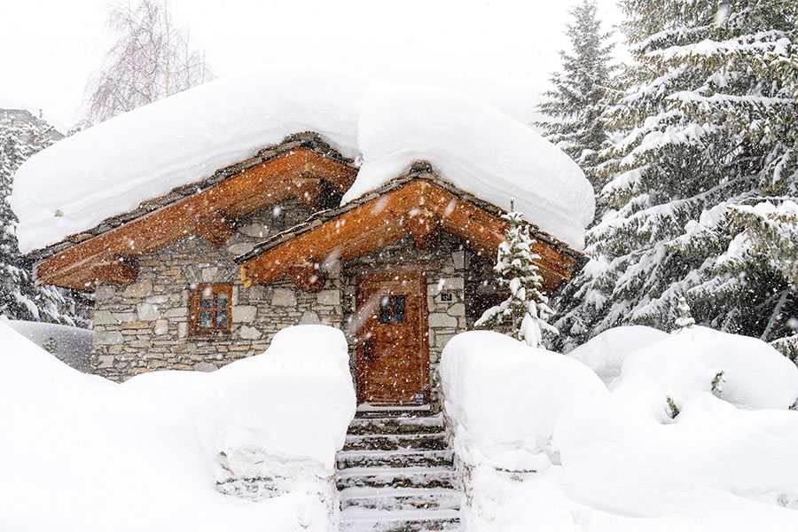
Val d'Isere, and much of the French Alps, looks like this right now...
Heavy snowfall has hit Europe, bringing up to 1.5 m (5 ft) in parts of the Alps and Italy with extreme avalanche danger, major resort closures and widespread cold, while Scotland reports its best snow in five years, eastern North America faces intense cold, and powder conditions continue in Japan.
The Snow Headlines - February 12th
- Biggest snowfall of the season in the Alps, up to 1.5 m/5 feet and still dumping.
- Avalanche danger at maximum Level 5, La Plagne and others close all slopes.
- Local media report the heaviest snowfall in the Pyrenees for 30 years.
- After a frigid January, temperatures fell even lower in eastern North America.
- Ski Scotland says snow cover in the Highlands is the best for five years.
- Huge snowfalls in eastern Italy — up to 1.4 m/5 feet in 72 hours — with very high avalanche danger.
For the Alps, lighter snow is forecast for Friday and Saturday: if you're travelling this weekend, expect delays but look forward to epic conditions!
Yes, that's more Snow forecast on top of what's already fallen today.
Re-publication :- the J2Ski Snow Report Summary, being the text above this line, is free to re-publish, but must be clearly credited to www.J2ski.com with text including "J2Ski Snow Report" linked to this page - thank you.
World Overview
Heavy snowfall has returned to parts of Europe, with western and southern ranges seeing the largest totals. Some resorts reported up to 1.1 m/4 feet in the 36 hours to Thursday afternoon, with snow still falling. The heavy snow has pushed avalanche danger to the rarely seen maximum Level 5 Risk across a wide area.
The latest storm follows substantial weekend falls in the Pyrenees, the southern French Alps and the Italian border regions. This time the storm track pushed further north in France too, delivering more than half a metre to resorts in the Northern French Alps and with much more forecast.
Before the current falls, standout totals had been on the Italian / Slovenian / Austrian frontier, where up to 1.5 m/5 feet fell.
Scandinavia remains bitterly cold, while all five Scottish ski areas are operating together for the first time in two years when conditions allow.
Across the Atlantic, the long-established east-west split is softening as new Pacific fronts bring modest snow to the Rockies. It has been even colder in the east though, down to the -30s°C/ -22F.
Conditions in Japan continue to look spectacular.
Europe
Austria
A mostly sunny spell has settled over the Austrian Alps, with only light top-ups of a few centimetres of snow. Temperatures have lifted, reaching around +5 °C/+41 °F in valley bases and dipping to roughly -5 °C/+23 °F on higher slopes.
Most resorts are operating at 80–100% despite below-average base depths. The Arlberg currently leads with around 240 km/149 miles open and also has the deepest reported snow (1.6 m/5 feet) other than at glacier level (slightly more at Pitztal and Kaunertal).
The week ahead stays changeable with cold mountain temperatures, moderate ridge winds and light snow showers building to 10 cm to 20 cm/4 inches to 8 inches over the weekend.
France
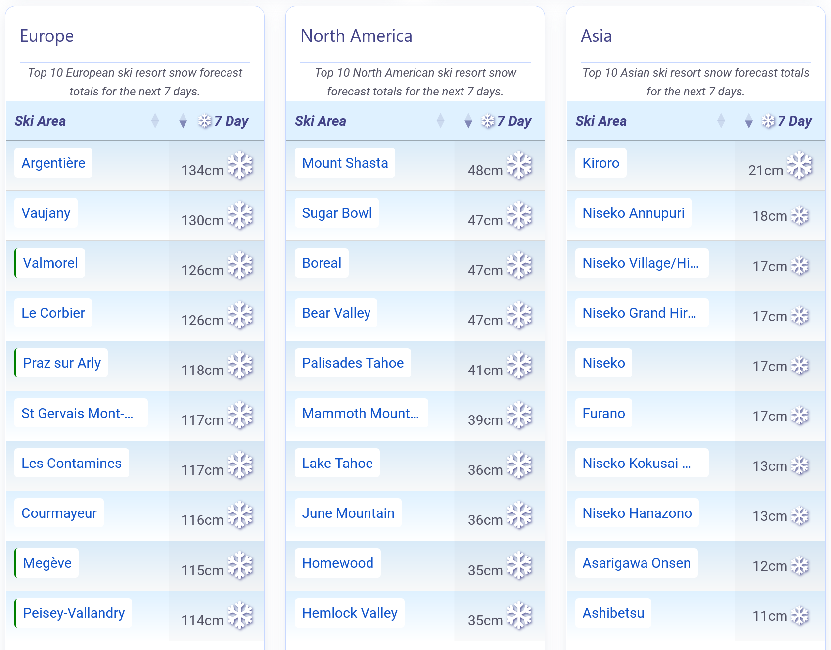
A major weather system is currently hitting the French Alps after last weekend's 20 to 60 cm/8 to 24 inches accumulations in the southern Alps and a brief sunny spell. Fresh falls of 10 to 20 cm/4 to 8 inches returned from Tuesday, with heavier snow building over the last few days so that by the end of the ski day on Thursday most resorts had had at least 60 cm/24 inches, some including Chamonix and Courchevel reporting more than a metre.
The snowfall is continuing as we publish and some resorts are forecast to receive another metre by the weekend, though rain or sleet is possible at lower altitudes and strong winds are an issue, reportedly hitting 100 kph/62 mph up at 3,000 m/9,843 feet.
All this has driven avalanche danger levels to very high '4' and in some areas such as the Tarentaise Valley a rarely seen maximum '5', meaning open terrain is very limited and, in the case of La Plagne and several other ski areas, everything was closed on Thursday.
With French school holidays underway, most resorts had been fully open and benefiting from deeper cover and they will want to return to that as soon as possible. The unsettled pattern persists, with strengthening winds during passing fronts and the next wave of heavy snow expected early next week once the current storm ends.
Italy
It was Italy's north-eastern corner that saw the biggest snowfalls as intense storms travelled across the bottom of the continent. Sella Nevea on the Slovenian border reported 1.4 m/5 feet in 72 hours, with nearby Tarvisio picking up 105 cm/41 inches going into last weekend.
This sudden deluge pushed avalanche danger to level 4, very high, with resorts warning of a high likelihood of spontaneous avalanches. Unfortunately a snowboarder died off-piste near Tarvisio.
Although these were the largest falls of the past week, much of Italy saw fresh snow as the 2026 Winter Olympics got underway at host venues including Bormio, Livigno and Cortina d'Ampezzo.
Switzerland
Switzerland has seen some snow in the south and west, but most regions enjoyed a dry, sunny start to the week.
That changed over the past 48 hours as colder, unsettled weather returned, bringing frequent snow showers widespread across the country, heaviest in the south and west. Freezing levels have hovered between 700 m to 1700 m/2,297 feet to 5,577 feet, with -12 °C/+10 °F still possible at 3,000 m/9,843 feet and the potential for up to 1.5 m/5 feet of snow up high by the weekend.
Major areas such as the 4 Valleys, Portes du Soleil and Zermatt are currently 80–90% open, while eastern resorts sit nearer 60%.
Scandinavia
Scandinavia remains locked in another brutally cold spell, with upper‑mountain temperatures between -36 °C/-33 °F and -10 °C/+14 °F and bases from -20 °C/-4 °F to -5 °C/+23 °F. Snowfall stays light and occasional, mainly in exposed Norwegian and Swedish areas, but the extreme cold keeps conditions consistently dry and crisp. Northerly Lapland remains the coldest area. Winds are mostly moderate, freshening on higher ridges.
Pyrenees
Parts of the Pyrenees have reported their heaviest snowfall in 30 years over the past few weeks, with Les Angles in France recording up to 1 m/3 feet in 48 hours. The wider range has enjoyed a consistently snowy winter, with base depths now exceeding 3 m/10 feet at freeride centre Ordino Arcalis in Andorra and more snow still falling.
Even Portugal's Serra da Estrela was briefly closed while crews dug out from a huge snowfall.
This week stays cold and unsettled, with 10 cm to 20 cm/4 inches to 8 inches of daily snowfall, -17 °C/+1 °F to -2 °C/+28 °F on upper slopes, and milder bases. However, many centres were closed on Thursday due to very strong winds.
Scotland
All five Scottish Highland ski centres are open for the first time in two years, with Nevis Range welcoming skiers again for the first time since 2024. Strong winds and road shutdowns have still caused interruptions, particularly at Glenshee and The Lecht, but the weekend delivered more than 40 lifts and close to 100 runs open nationwide, the most for several years.
After six sub-zero weeks, temperatures have nudged upward, bringing springlike conditions and some rain-related thinning of the snowpack, although snow has also fallen overnight. A changeable week lies ahead, with -7 °C/+19 °F to -2 °C/+28 °F on summits, frequent snow showers, and brisk westerly winds.
Eastern Europe
Eastern Europe's ski conditions remain encouraging, helped by strong snowfall late last week in Slovenia and steady top-ups across Bulgaria.
Many resorts now hold more than a metre of snow on upper slopes, with Bansko posting 20 cm to 150 cm/8 inches to 59 inches and operating at 98%.
It has been a wintry, changeable week. Further light to moderate snow is expected in Bulgaria, Slovakia and southern Poland, while Slovenia and Czechia stay colder and drier. Winds remain mostly moderate.
North America
Canada
Western Canada has seen another quiet week for snow, continuing the pattern after December's exceptional totals in Alberta and eastern British Columbia.
Temperatures have dipped again, with most resorts staying below freezing and upper‑mountain lows near -10 °C/+14 °F, while only the Pacific Coast has seen milder conditions on lower slopes at resorts like Whistler Blackcomb.
Most areas remain fully open, led by Revelstoke with the region's deepest base 2.5 m/8 feet. Eastern Canada has endured severe cold again, with -15 °C/+5 °F to -25 °C/-13 °F common, light daily snow, and major centre Tremblant fully open.
USA
America's long‑running weather split is finally showing signs of easing, although it is too early to know if this is a blip or a longer-term change.
After weeks of springlike warmth in the west and deep midwinter in the east, new Pacific systems are pushing fresh snow into the Rockies. Early precipitation fell as rain at higher elevations, but colder air has lowered the snow line and delivered a much‑needed top-up for resorts that have endured a lean spell. Some areas in Oregon and Washington remain closed for now, though hopes of reopening soon are rising.
Meanwhile, the east has doubled down on winter, with temperatures sinking deeper into the -20s °C/-4 °F range and the -30s °C/-22 °F range than in January and wind chill forcing some precautionary lift closures. Despite the snow shortage in the west and brutal cold in places, most US ski areas remain largely open, with many big-name resorts at 75–100% open, though with thin cover in the west.
Join the conversation : Discuss this in the J2Ski Forum
This news item has been viewed 280,832 times.
Also on J2Ski :- La Plagne Snow Forecast Ski Hotels Ski Hire Ski Holidays